


Recent Ukrainian Counter-Offensive Progress: Beyond the Surovikin Line
Changing Dynamics: Fire shifts deeper towards Ocheretuvate

From recent video geoconfirmations, it's clear that the UAF are actively operating near Verbove and Novoprokopivka. Satellite analysis, based on observable landscape changes, supports it and shows fire shifting toward both Verbove and the southern part of Novoprokopivka.
On its own, a scorched or shelled landscape doesn't necessarily confirm troop presence. However, when the fire consistently moves deeper, it signifies a gradual advance, as it targets positions further within the area of engagement

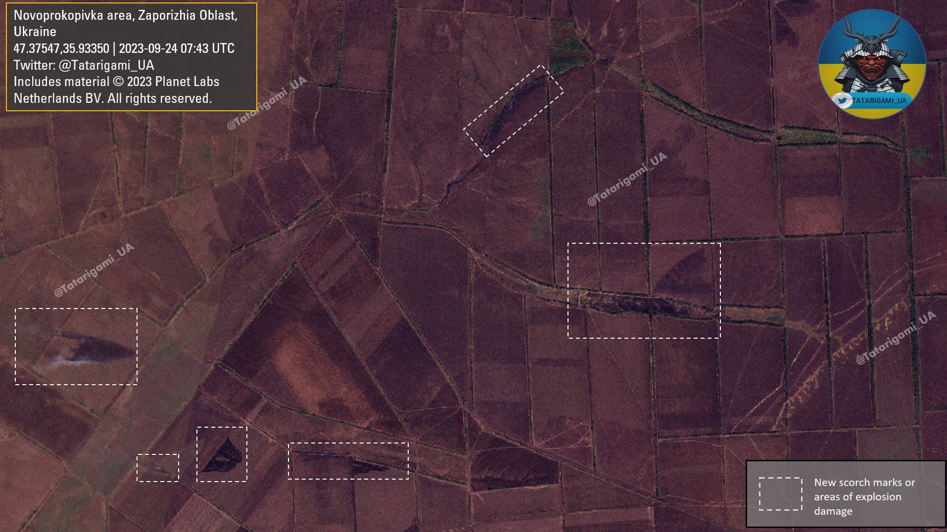
This image displays scorch marks and shelling marks, showing recent combat activity. Given the ongoing southward progression of the fire toward Ocheretuvate, it is very likely the AFU pushed russian forces from their positions in the vicinity of Verbove and Novoprokopivka. These specific fires are situated just north of Ocheretuvate, a town positioned along a road leading to Tokmak.
To better understand the tactical situation, terrain comprehension is essential. The landscape is mostly flat, with slight elevations as shown on this map. Keep in mind that these elevations are in relation to the generally flat terrain, and the red color may not always represent dominant hills. Nevertheless, due to some depressions and small hills, these elevations do offer certain tactical advantages, and it's worth noting that some of them remain under russian control.

The presence of visible scorch marks within Verbove itself, as well as on its western outskirts, corroborates previously identified photo and video evidence indicating the engagement of the Armed Forces of Ukraine and russian occupational forces in the vicinity of Verbove.

I want to emphasize that russian defense has not collapsed. Despite enduring substantial losses and being compelled to retreat, they still maintained control over their forces and afforded organized retreat, continuing to present a formidable challenge to our forces.
Russian reserves are not depleted, but it's important to note that they are not entirely intact either. Additionally, there are still minefields present in subsequent defense lines. As a result, I maintain a cautious and careful approach in my estimates and analysis
In this 3D terrain simulation, you can observe that minor elevations can provide certain tactical advantages. This simulation combines the current satellite image with terrain data. Although it is far from perfect, it will be integrated into all future analyses.

In summary, it's important to recognize the substantial progress in the Verbove-Ocheretuvate-Novoprokopivka area. Both russian and Ukrainian forces have deployed their reserves, resulting in significant attrition that has compelled russian forces to retreat. However, it's worth noting that Ukrainian forces are also facing challenges, including a dwindling supply of ammunition provided by South Korea via the US. Furthermore, all units prepared for the counter-offensive have already been engaged, making it increasingly challenging to capitalize on any breakthroughs when it happens.